- Guyana's coastal communities and fishing industries will benefit from improved sea mapping
- UK experts will train Guyanese maritime staff in cutting-edge survey techniques
- Stronger ocean data will support sustainable economic growth and climate resilience
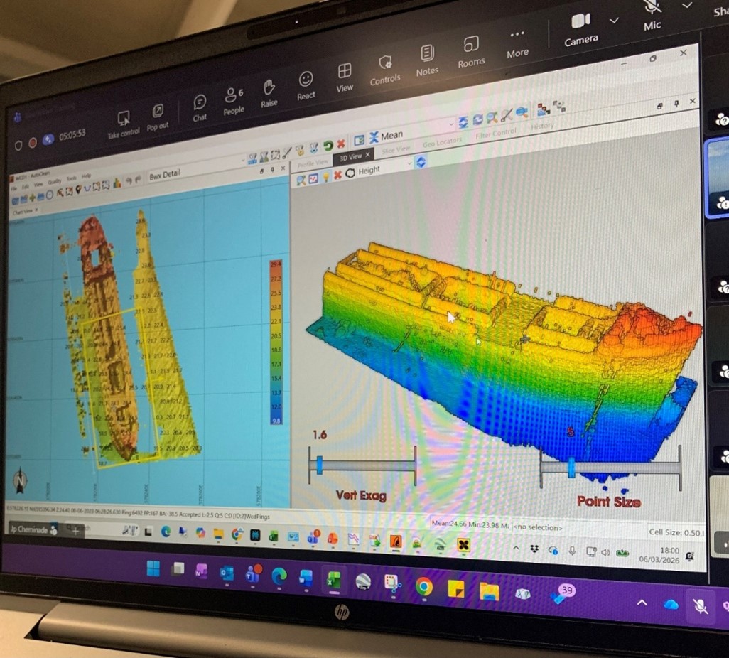
Fishing communities and coastal businesses in Guyana are set to benefit from improved seabed mapping, as the UK Hydrographic Office (UKHO) partners with Guyana's Maritime Administration Department (MARAD) to strengthen the country's capacity to survey and manage its waters.
Over 90% of Guyana's population live along the coast and waterways, which underpin the country's economy. This partnership will give Guyana sustainable access to high-quality seabed data — the foundation for safe maritime trade, fisheries management, and protecting coastal communities from climate change.
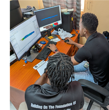
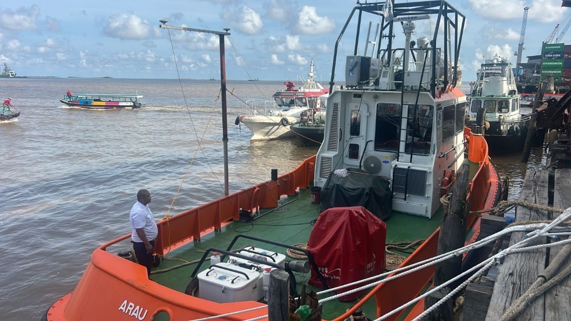
UKHO specialists are working directly alongside MARAD survey teams to share knowledge, transfer best practice, and calibrate the survey equipment on board Guyana's new vessel, the Arau. One MARAD staff received formal hydrographic training at a UK-based internationally accredited institution over a five-month period.
The project builds on previous UK Government support delivered through the Commonwealth Marine Economies Programme, which helped Guyana supply hydrographic data to UKHO for update nautical charts for key maritime traffic routes. UKHO staff spent 4 weeks with the MARAD team, embedding best practice in data collection, processing, and validation.
Strengthening Guyana's ability to chart its own waters is a policy choice — investing in local capability rather than external dependency — so that Guyana can continue collecting vital data for years to come, independent of outside support.
This partnership directly supports Guyana's Low Carbon Development Strategy and contributes to the UK Government's Plan for Change commitment to sustainable international development, protecting livelihoods, and building a resilient blue economy.
British Deputy High Commissioner to Guyana, Liam McShane noted
“The UK is proud to work in partnership with Guyana to strengthen the country’s hydrographic capabilities. This initiative reflects our long-standing commitment to supporting coastal nations and Small Island Developing States in their efforts to build the skills, tools, and evidence needed to safeguard their marine spaces. This partnership will see investment in local capacity building and the transfer of expertise to Guyana’s Maritime Administration, thereby reinforcing their efforts to create the conditions for safer navigation, resilient coastal communities, and sustainable blue economic growth.”
Mr Troy Clarke of MARAD added,
"The partnership between Guyana and the UKHO continues to deliver substantial benefits, as the Surveyors have benefited from continuous training opportunities, which have provided updated survey data and quality control to improve navigation safety, and, most importantly, enabled successful participation in the IHO Empowering Women in Hydrography. "
UKHO deployments to Guyana took place in October 2025 and March 2026 as part of the Sustainable Blue Economies Technical Assistance Programme, which enables Small Island Developing States (SIDS) to request specialist assistance from a partnership of UK marine science and management organisations to co-develop the evidence, tools and capacity for climate resilient, equitable sustainable and sustainable blue economies.
- Log in to post comments